 Free Shipping from $105
 wear for 30 days risk free


Written by Martina Novakova
It’s Thursday morning and we are waiting at the ferry terminal in Nanaimo for the West Coast Trail express bus. It is an hour drive to Lake Cowichan where we will transfer to the main bus and drive over 2 hours on old logging roads to Pachema Bay trail head. The little bus is full of hikers excited to start a new adventure. Some have already hiked the trail, some are new like us, the driver shares great stories about the people who embark on this adventure and we are starting to get excited.

West Coast Trail is a 75 km backpacking trail on Vancouver Island in British Columbia, Canada between Pachena Bay near Bamfield and Port Renfrew. Originally constructed in 1889 as a communication system called Red Route and improved in 1907 to assist survivors of the many shipwrecks along the rugged shores. It was named Life Savings Trail in the area known as Graveyard of the Pacific. Over 50 ships have crashed along the coast in the last 100 years, several pieces of these ships and other old equipment from many years ago used to clear the trail and logging operations can be seen along the trail. In 1970 Pacific Rim National Reserve was formed and Parks Canada now works with Huu-ay-aht, Ditidaht and Pacheedaht First Nations operating the trail.
Every day between May 1st and September 30th, 70 hikers in total, can start their adventure at 3 different entry points. Space must be reserved ahead, usually all spots are taken by the first day the reservation system is available online. Hikers can start the trail either in Pachena Bay and trek south or they can start in the south at Gordon River and trek north. For the last couple years and entry has been allowed at the halfway point at Nitinaht Narrows (at the 32.5 km). Water taxi must be taken from the First Nation village at the Nitinaht and this is also the only place where a person can leave the trail if not able to continue.
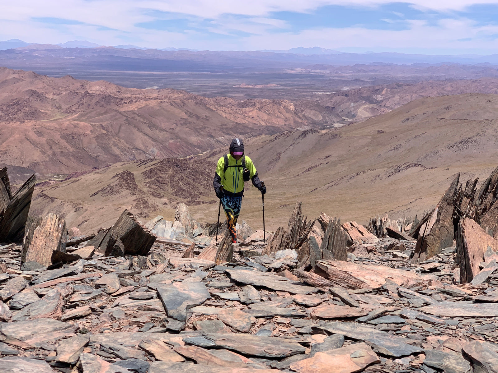
The irregular trail, which consists of 70 ladders, 130 bridges, and four cable cars, requires hikers to cross deep ravines and navigate the great wilderness. It’s every hiker’s dream and we were so excited to be there to experience it.
It has been raining heavily the last week, the Pacific West Coast received over 100 mm of rain in just 3 days. We were listening to stories of how bad the conditions were on the trail and how just that week 35 people had to be taken of at the halfway point as not able to continue.
Majo has been an ultra runner for many years now and we have always done adventure things together. We knew friends that run the trail in less than 24 hours, and we decided we would fast pack it in 3 days. Our start date was Friday and we had a flight Monday night back to Calgary. It all sounded so great, we can do this, how hard can it be.
We each had a pack weighing little under 28 lb, carrying food, tent, sleeping bags and pads, headlamps, rope to hang our food, some extra clothes and cooking gear. We decided to use our rolled top dry bags as it was forecasted to rain heavily at least one of the days. They were not the most comfortable to carry but when the rain started to pour, we knew it was a great choice.
Every hiker must attend an orientation session before being allowed to start the trail. Parks Canada issues you an overnight permit and gives you a waterproof map with tide tables. You can attend the orientation the day before, but you can only start on the day of your permit. We got to the Parks Canada office on Thursday afternoon and attended the 2 pm orientation. Hearing how bad the conditions were, we wanted to start that day. Unfortunately, we were told that there are no openings as everyone came in for check in for that day. Realizing that we will have to hike 40 km the first day to make it, we sat through the orientation. You get to learn about any hazards, trail conditions, how to read the tide tables and how to call for help if anything happens. There is no cell phone coverage along the trail, you either have to be evacuated and that is after you are able to either call for help, reach guard cabin, send message through an In-reach satellite device or hike 32 km to the half way point. The remoteness of the trail is what makes the adventure that much more dangerous. We were the only ones that were carrying the In-reach device, which was great as we could get weather reports, send text home and track our journey as well.

As the rain started, we begin to walk to the camp to set up for the night and get ready to start very early next day. Suddenly we hear someone running after us and this couple of hikers that were supposed to start that day, decided to stay, get some sleep and start the next morning. When they learnt that we were looking to trade they ran after us so we can change our permit. This was the best news; we will be forever grateful to this anonymous couple who let us go that day. We would have not made it if we did not start that afternoon. We run to the parks office as it was almost closing and changed our permit. The lady was so excited for us and cheered us on as we started the journey.
It was 4:15 pm on Thursday afternoon, we had only had breakfast and bag of M&M’s that day, but we knew we had to go to make it to the first campsite by dark. 12 km to Michigan creek. As the tide was rising, we could not take the beach route, so we went inland. The ladders started right away. West coast trail is known for ladders, some even as high as 30 story buildings. Our packs at the heaviest, we started to move at high pace. It was so exciting to see the rain forest and hear the waves, hundred year old trees, the boardwalks and rain. We were there, hiking the West Coast Trail.
During the orientation we were told that there were 3 momma bears with cubs on the first 8 km of the trail. If this was in Alberta, the trail would be closed for days but I guess here, bears are used to people, you just must keep your distance. About 6 km in we could hear people shouting in front of us, suddenly Majo says to me to stop, there is a bear. You could see human footprints in the mud and bear tracks on the top of them. Suddenly there he was, biggest black bear I have ever seen, strolling on the trail right in front of us. He joined us for about half a km and then disappeared to the berry bushes. What a way to start the hike. In 2.5 hours, we made it to Michigan as the sun was setting down. Tired from a long day, we set up a tent. There are creeks in most camp sites, but all the water must be treated. Majo did an amazing job filtering our water and making sure we were hydrated all the time. We were happy as we moved quickly, and weather was holding up. We set up a tent, cooked dinner and spend an evening watching the waves and sunset.

Friday: The next section of our hike was tide dependant. As we were wanting to cover a long distance, there was a stretch of the trail that was only passable at low tide. This meant waking up early and covering a big distance the next day. We set a goal of hiking 30 km and making it to kilometer 42 km by Friday night. The alarm went off at 5:30 am, we cooked breakfast, had coffee, pack the camp and as the first sun light was coming out, we were on the trail again. The first 10 km that day were all on the beach. What an amazing site. The Pacific Ocean, sandy beach, tracks of many animals on the beach made us wander what all was around us. There are cougars, wolfs and bears mostly. We only saw the bears. We saw seals and walked pass tide pools with different life, incredible morning. As we approached the 22 km mark, we had our first cable car. Now these are so much fun. You pull yourself as you need and let the gravity do the rest. We were lucky as another couple was going through and Majo helped to pull them over and then they helped us. The true comradeship is incredible between the hikers on this trail.

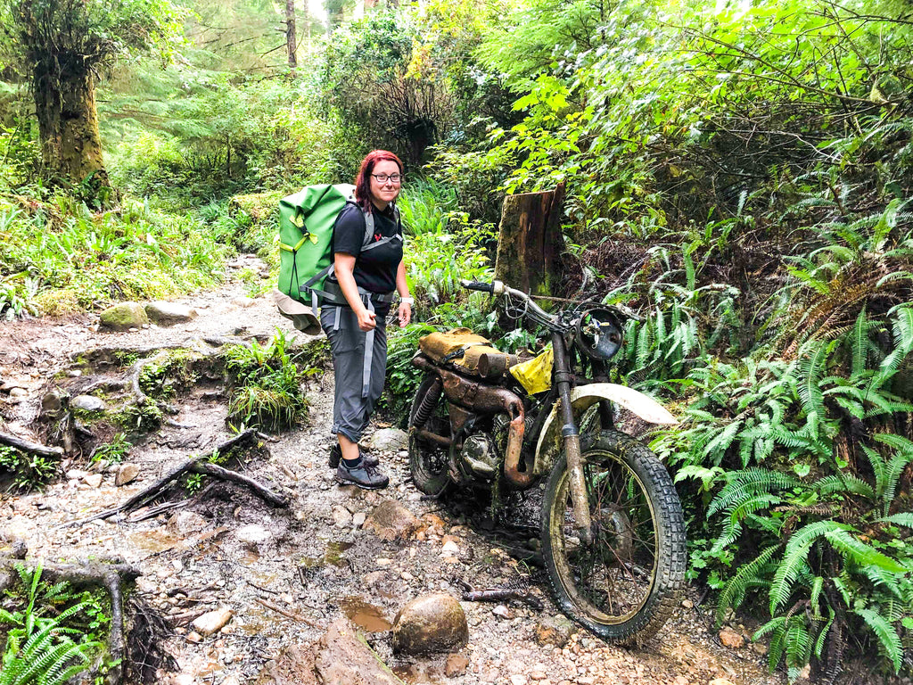
Trail was nice that day, boardwalks in the rain forest, the typical red dirt with few mud sections and several ladders. We saw so many beautiful sites that day, Tsusiat Falls and incredible views from the cliffs, we even got to see the boiler from the ship called Michigan that run a ground in 1893 that is still visible during low tide.
This section has also no water between 30 and 40 km mark so we had to carry a bit of extra water that day. As of 28 km, the mud started to show. We heard stories of people falling in knee deep in the mud, but this was something else. Roots of old trees, broken boardwalks and mud pools that were just never ending. It slowed us down to the point of moving only at about 2.5 km an hour. Imagine that. The sun came out briefly in the afternoon and this was a nice break. So far, we were lucky to see no rain. At km 32 you must take a boat to cross the Nitinaht Narrows. It only takes 3 minutes and the locals that run the ferry also run a Crab Shack in the same spot. Majo shouted across and little boat with a cute chocolate lab appeared to pick us up. You could smell the fresh fish cooking as we approached the deck. Many hikers sitting there coming from the south already eating. We had halibut with a fully loaded baked potatoes and ice cold can of coke. The best $100 I ever spent. Many people were considering exiting at this point as we were hearing that the next section of the trail is hard and destroyed from the rain. We quickly ate and continued. There is no camping from this point until 42 km as it is a protected native land and high traffic wildlife area. It is however the most beautiful walk on a sandy beach on a grassy trail. What an incredible end of the day. We made it to Cribs camp at 42 km at 6:30 pm. Almost 12 hours on our feet and so excited to set up camp. Taking the shoes off and letting the feet rest in the sand. It was great to hear encouragement from fellow hikers when we told them we hiked 30 km that day. Who does that; right?

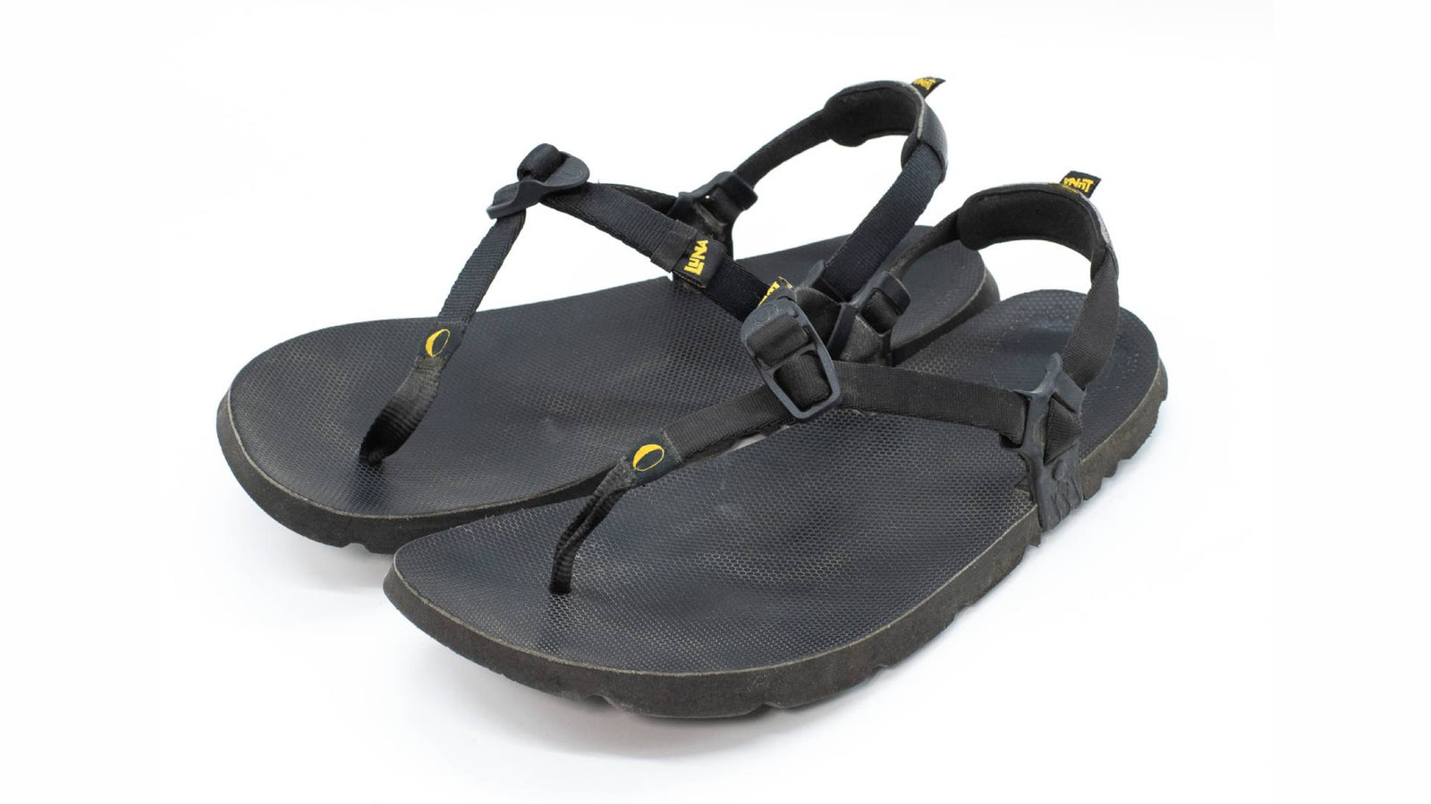
Saturday: We had 33 km of the hardest part of the trail left. Another section that needed to be passed at a low tide, so we again woke up early and were hiking by 7 am. We chose to keep our Luna sandals on for the beginning of the morning as we really wanted to get a break from the mud and inland trail and made good progress walking the beach. We knew that this day we had the most ladders, cable cars and mud ahead of us. The ladders were nice to see, good conditions, some missing few steps here and there. We made it to the largest suspension bridge at Logan Creek. It is barely wide enough for one hiker to go through it and you must climb several ladders equaling height of 30 story building to and from the bridge. The views were just incredible. We knew we had a long day a head of us and as we did not eat a lot in the morning, we decided to have a little lunch at the top of the trail with views of the pacific and Majo cooked us a quick pasta meal. Best decision of that day. At this point the trail became extremely hard to get through. The mud was so deep, broken boardwalks, exposed tree roots, mud pools knee deep. At one point we were barely moving at 1.5 km an hour. Our feet were full of mud, it was almost better to try to get through the mud pools than spend extra time to try to get around it. We were hoping to make it to km 70 but as we encounter more and more mud and difficult terrain, we knew we would have to set up camp at km 65. We met a group of girls that were moving fast, and they told us that the last section took them 1 km an hour of moving speed. We were starting to worry we will not be able to finish on Sunday.
There is a saying that hikers talk about a lot in the camp: “It is a good decision until it is not” and that was so true. You don’t know if you are making a right choice until you get stuck in the middle of the night in the rain forest and have no place to stay. With that, we decided to hike down to the camp at km 65 Campers Bay. What an incredible site, sheltered from the ocean with a beautiful creek and little cable car that you must take to get out. We set up a camp and had the most amazing dinner, I think Majo even had a chocolate brownie that he made, drunk some coffee, ate pasta and watched the ocean. Every designated camp has a composting toilet for hikers (of course they are high up and you have to climb a ladder to get there) but it is nice to have as well as bear boxes and bear poles to hang your food. Thankfully it was not so busy at any of the sites, so we had enough room to keep our food in the boxes. We did carry a 15 m rope just in case which added to the weight of the packs.
Just as we went to sleep the rain started. Majo got the weather report from his In-reach and what we have been hearing was coming true. Heavy rain was about to start. We had 13 km to the finish line and the final ferry. The last ferry was at 3:30 pm and if you did not make that ferry you would have to camp in the woods totally exposed until the next morning. This combined with hearing the stories of difficulty of the trail ahead of us, we made the decision to start at 5:30 am and hike with headlamps to make up the time. The rain was the heaviest as 4 am approached. We packed up our tent and at exactly 5:30 am we were sitting in the little cable car rolling it across the creek as rest of the camp slept. The rain was pouring down. The hike up from the camp is all up hill with ladders and exposed rocks, at this point it was a stream coming down from all the rain. We walked with the head lamps and at one point were laughing at the adventure it was. This next section of the trail is the closest to what the West Coast trail was like in the early years. No boardwalks and bridges, rugged with trunk of trees and logs used as walking boards over ravines and creeks. Some so high that if you were to fall, there would be no hope in saving you. A true rain forest with muddy sections and roots of trees, ladders and rocks. The real adventure. The rain kept pouring and we were soaking wet. 
We ended up making a great time and moved at over 2 km an hour and then reached the sign for the last 5 km. The bridge across here was washed out so we had to pass the creek. We were expecting a hard trail and were pleasantly surprise by the nice trail in the woods, some exposed rock climbing as the water was running down and ladders but much better than what we expected. Once we passed the old Donkey engine by 72 km, I knew we were going to make it that day. By 12:15 pm we reached the final ladder and Majo raised the yellow ball to let the ferry operator know we are there. Cold, wet but so excited we finished. We made the incredible trek and will never forget it. Once we crossed the passage, we signed off at the Park Canada office and caught a ride in a garbage truck from the local campground to town. What an adventure and what a trip. Respect to everyone who made it that week in those conditions. Here is to a new adventure, preferably somewhere dry😊 .


Leave a comment (all fields required)